
Atlas the Netherlands Fricx 1712


Klubbat för:
3 000 SEK
Utropspris
5 000 SEK
Beskrivning
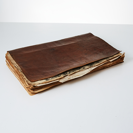
ATLAS OF THE NETHERLANDS. FRICX, Eugène-Henri. Table des cartes des Pays Bas et des frontieres de France [...]. Brussels 1712.
Large folio. With about 66 maps and plans, many double-page or folding, many battle plates / maps (not complete, lacking 11 maps, 1 defect). Size 380x460 mm. (for double page).Partly loose in soft leather cover. Signature of C. Ahnborg, Hedemora (Dalarna, Sweden).
Atlas by Eugène Henry Fricx who is considered one of the most important map publishers in the Southern Netherlands in the 18th century. The work contains views or plans of Brussels, Namur, Cambray, Arras, Lille, Dunquerke etc.
Konditionsrapport
Not complete. All maps partly loose, title repaired with tears, spotting. Maps with some spotting or foxing, some tears to margins. 1 map defect (no 6).
Auktionsnummer:
879724
Datum:
2021-03-21